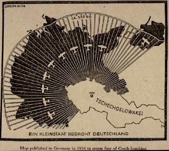
This propaganda map was created by Nazi Germany in order to give the population of Germany a false impression of Czechoslovakia's air-strike capabilities. It attempts to show the radial distance of the Czechoslovakian air force shrouding nearly the entirety of Germany. Interesting here is also the use of color, with the map almost implying that the planes will cover the country in darkness.
No comments:
Post a Comment